

On October 28, one week before the midterm election, L.A. TACO reported on the release of Icepick, a.k.a. DoP2, a dataset compiled from the data breach (or hack, if you prefer) of the Department of Homeland Security (DHS) by a group calling itself the Department of Peace.
The dataset is massive, containing information on “nearly a fifth of all DHS employees,” according to a press release shared by Distributed Denial of Secrets (DDoSecrets), the group responsible for sharing and releasing the database, and compiled into a searchable database thanks to investigative journalist and hacktivist maia arson crimew.
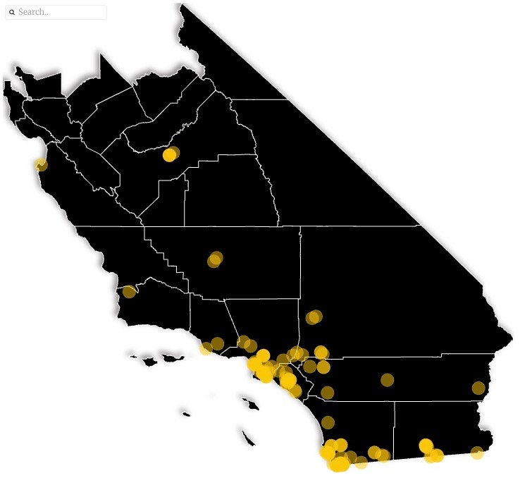
Nearly two weeks later, we compiled some of this data into the map embedded on this page.
Our map uses the location data collected in Icepick to place dozens upon dozens of sites in Southern California that DHS uses, or has used, to operate at least one of its many departments. These departments include DHS headquarters, ICE, Border Patrol, Homeland Security Investigations, and others.
The map reveals how vast DHS's presence is in our region and, more importantly, which departments operate in our own cities and neighborhoods. Each data point includes the name of the office or building, the department that operates there, and the number of employees listed in the data.
The data also reveals information about previously unknown locations. For example, DHS is renting space in a warehouse in El Cajon primarily used by different pool and spa wholesale companies. The data describes this site as a “special operations facility.”
See the map below for more details.