Skip to Content
Details

1934 Map of Public Transport in L.A.

10:10 AM PDT on May 23, 2012

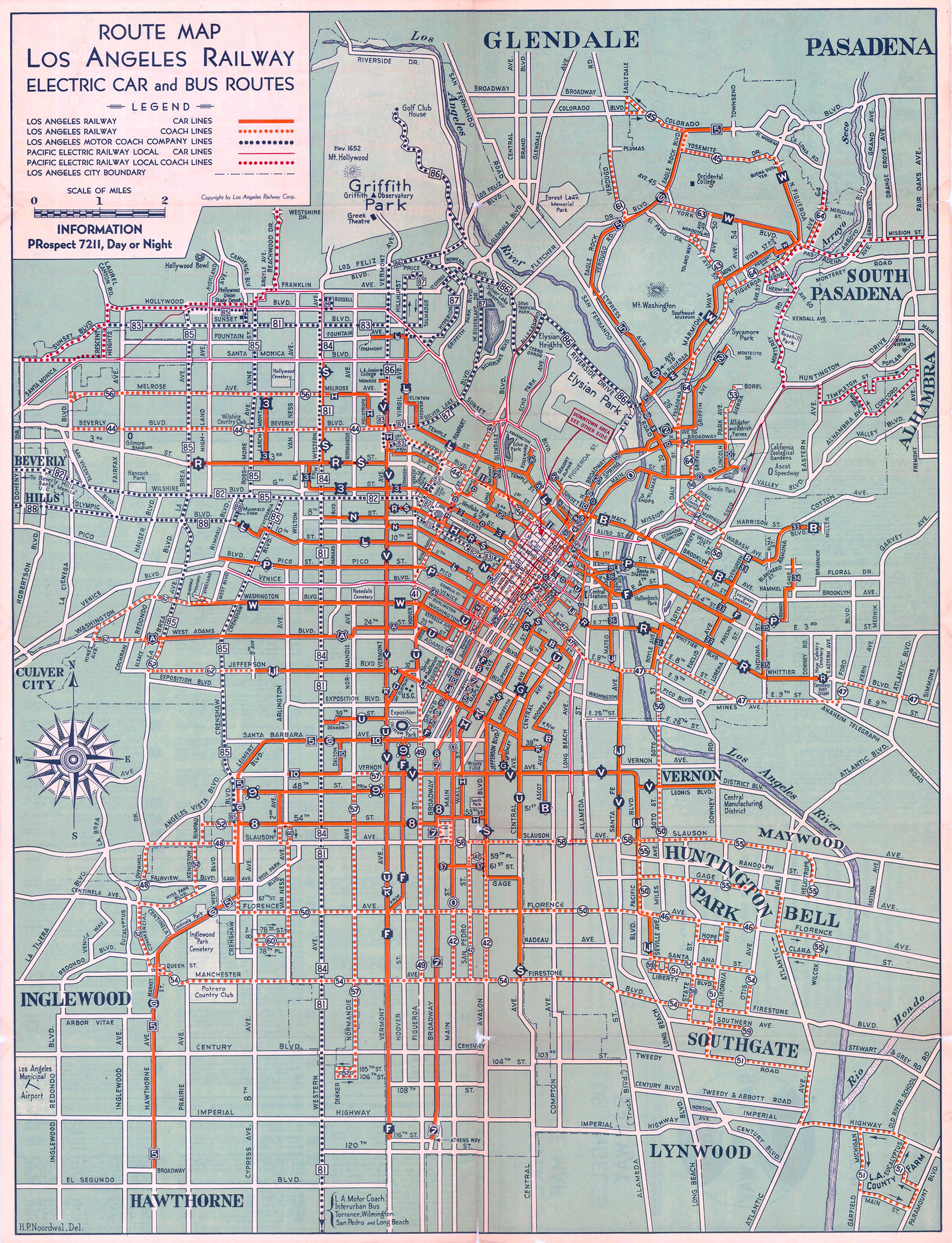
    We've discussed the history of street cars in Los Angeles before on this site vis a vis historical maps, usually posted (as this one was) by the great 59 King of the Big Map Blog. At the time of this map, automobile traffic was on the rise and the fate of the Red Cars (Pacific Electric Railway) was uncertain. Four years later, the service would start to be contracted and by 1941 many of the routes visible on this map were gone.

    This map also shows the beginning of the rise of buses, which are now the primary mode of public transport in the city. By the late 1940's, most of the Los Angeles Railway lines (yellow cars) would be replaced with busses. Click the map for the super large version.

    Stay in touch

    Sign up for our free newsletter

    More from L.A. TACO

    New Date for TACO MADNESS 2024 Event Confirmed: June 15th at La Plaza de Cultura y Artes

    After getting rained out, our new date promises to be our biggest and most fun festival to date. Come out and eat all the tacos, drink all the micheladas, dance to the best DJs in L.A., and support our independent journalism! Of course, L.A. TACO members get in for free. Tickets on sale now.

    April 29, 2024

    An Update On Our Membership Drive: Some Bad News, and Good News

    Some bad news, and some good news on our pledge to survive and stay sustainable.

    April 26, 2024

    How Your Business Can Benefit From Sponsoring L.A. TACO

    When your company sponsors L.A. TACO, you receive a variety of quick and cost-effective benefits for far less than what we price our traditional advertisements and social media mentions at.

    April 25, 2024
    See all posts